City routes, live traffic, transit routes, parking, offline map and navigation.
We are thrilled to announce significant updates to 2GIS – the current version struggled to showcase the wealth of information we've gathered about cities and companies. In the new 2GIS, we've revamped the design, introduced a new search system, enhanced city updates, and seamlessly integrated favorites with 2gis.ru.
Services, addresses, and companies
2GIS is your go-to source for comprehensive city information. Discover which service providers operate in your neighborhood, locate your nearest district hospital or post office, and select the perfect cafe or service center based on reviews and photos. 2GIS provides crucial details like opening hours and contact numbers, ensuring you're always in the know.
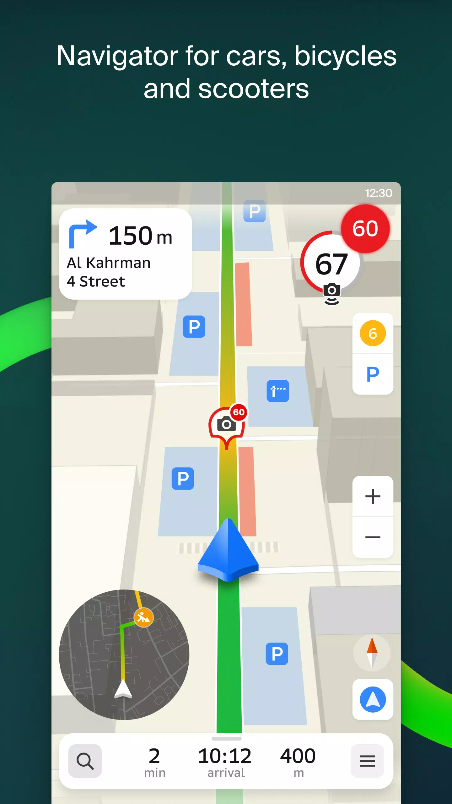
Transport and navigation
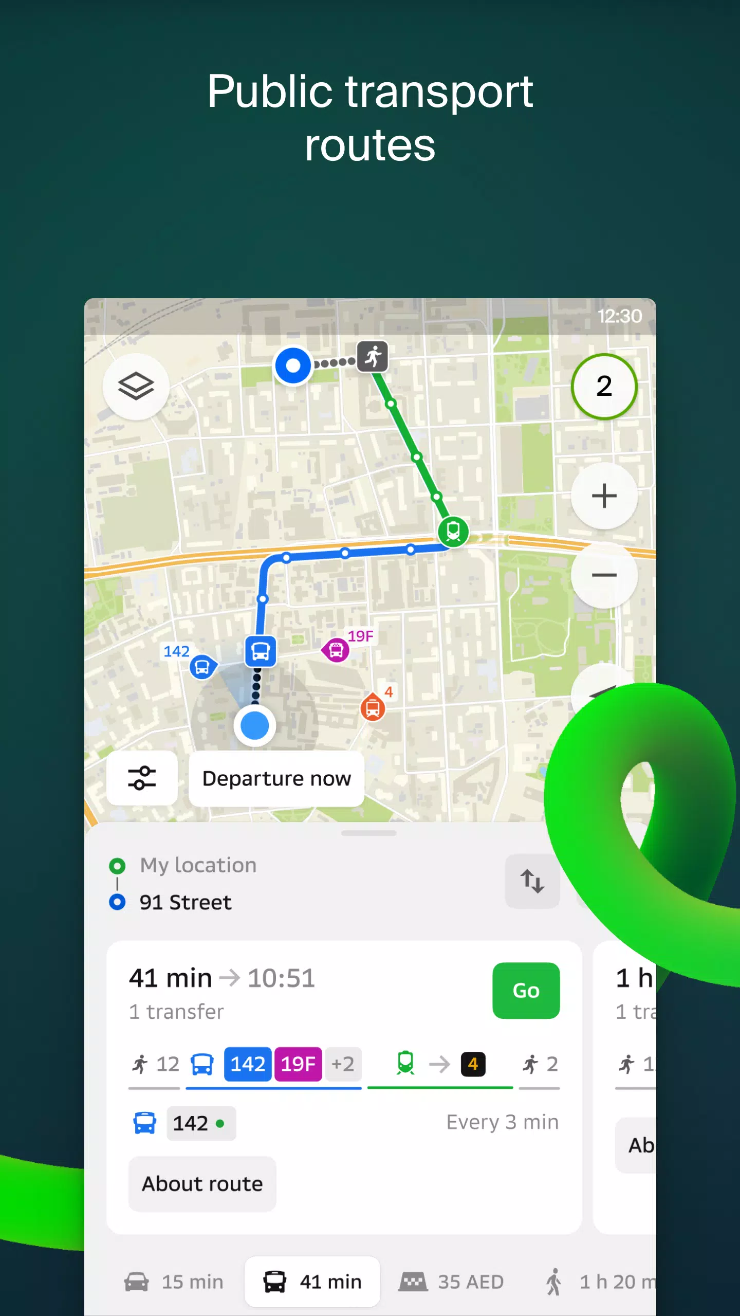
For drivers, 2GIS offers real-time navigation with voice instructions, guiding you through the city while considering traffic congestion and roadblocks. The app dynamically adjusts your route if you stray off course. For pedestrians, it maps out the most efficient public transport options, including buses, metro, trains, cable cars, and river trams.
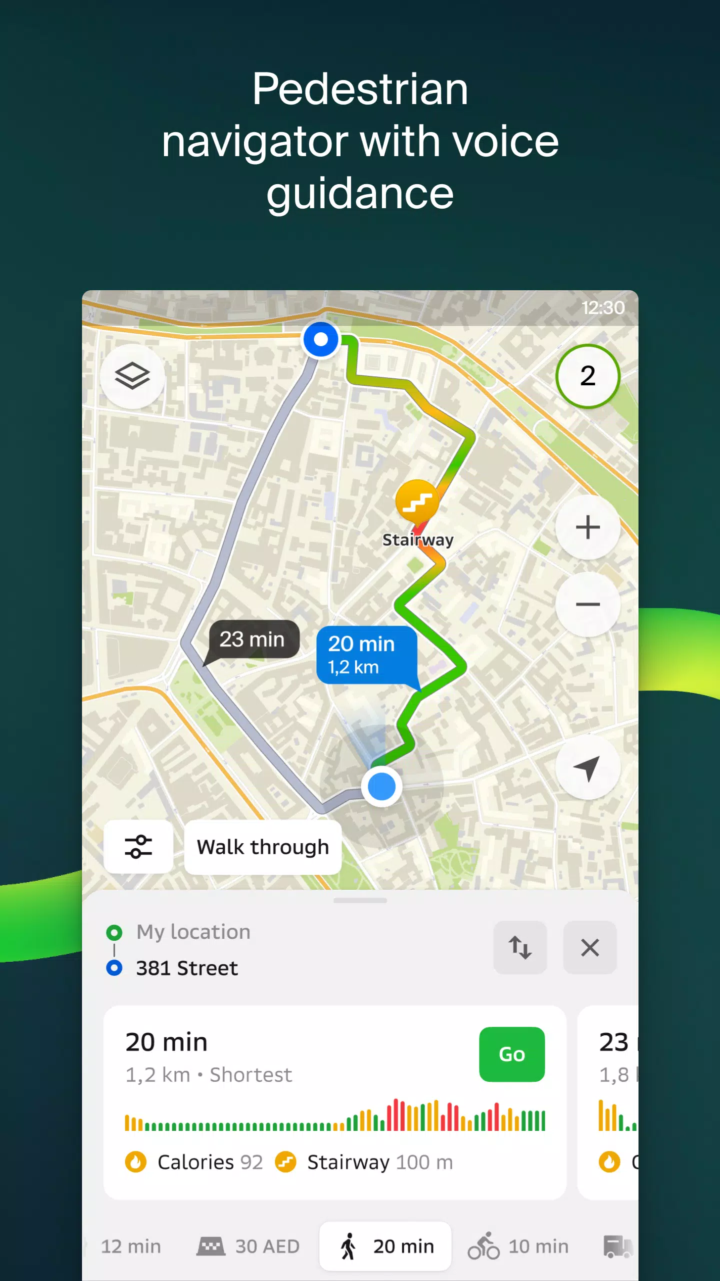
Walking routes
Our pedestrian navigation system charts the best footpaths, operating seamlessly in the background with voice guidance to keep you on track.
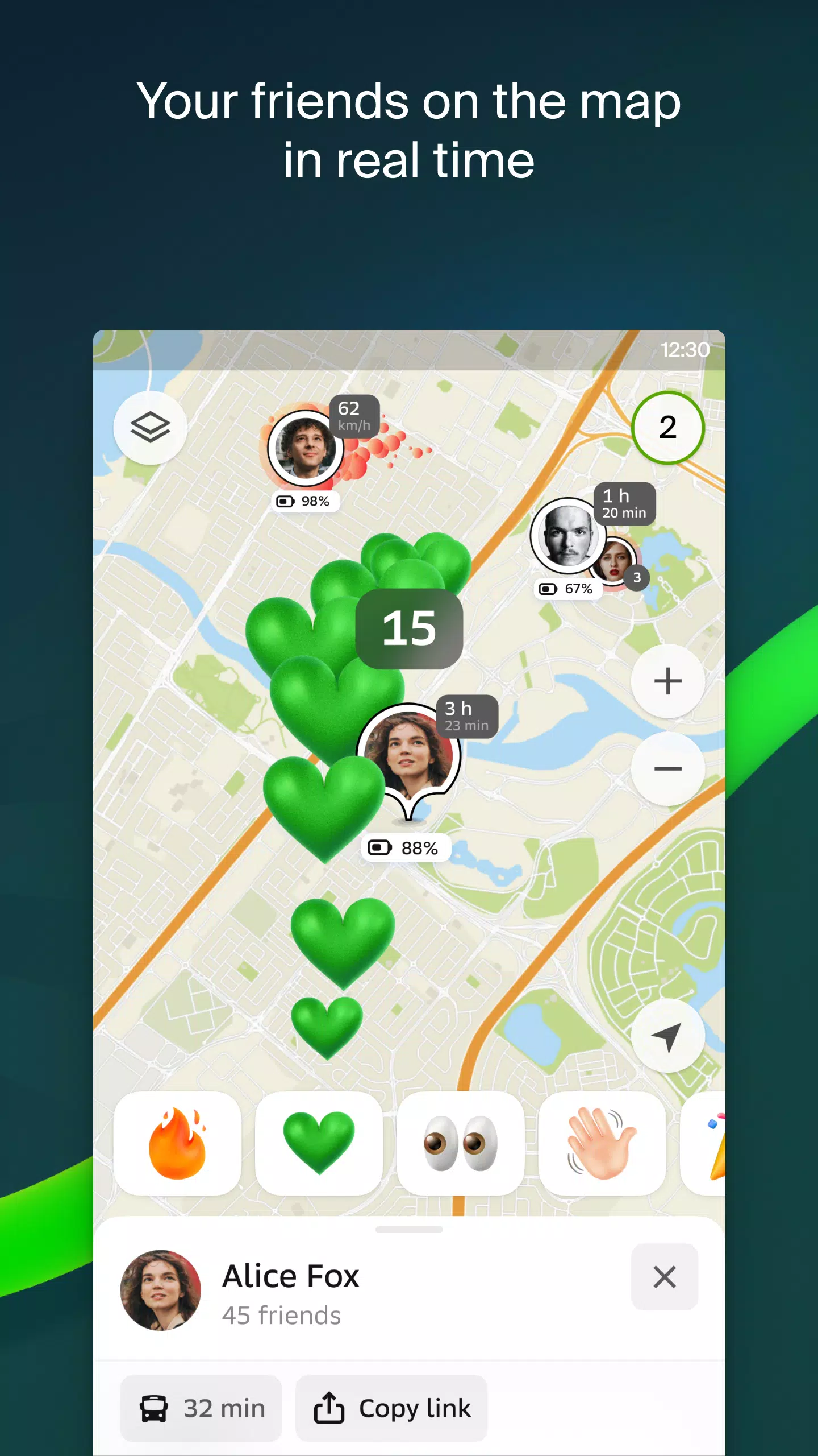
Friends on the map
With 2GIS, you can now track the real-time location of friends and family on the map. You control who you connect with and who can see your location, with customizable visibility settings.
Building entrances
Navigating to business centers is a breeze with 2GIS. The app provides access information for over 2.5 million companies, guiding you directly to the entrance, whether you're arriving by public transport or car.
Plans of shopping centres
Inside shopping centers, 2GIS is your ultimate guide, displaying everything from shops and cafes to ATMs and restrooms. Plan your visit in advance to maximize your time.
A 2GIS beta Notifications companion app for smart watches on Wear OS. This handy tool enhances your navigation experience for walking, cycling, or using public transport directly from the main 2GIS beta app. View maps, receive maneuver hints, and get vibration alerts as you approach turns or your destination bus stop. The companion app launches automatically when you start navigation on your phone and is compatible with Wear OS 3.0 or later.
By joining the beta, you'll receive the latest updates as we fix bugs and errors, playing a crucial role in shaping the new version of 2GIS that millions will use. You can run both the original and beta versions simultaneously, switching between them at your convenience.
Support: [email protected]
What's New in the Latest Version 6.44.1.559.3
Last updated on Oct 19, 2024
We're excited to bring you beautiful, crisp updates in our latest version: — Enjoy wide, realistic road displays on the main map and during route searches. — Introducing Chats for Friends! Now you can message each other directly on the map. — Receive notifications when a friend is nearby, with the option to disable them in settings. — Just in time for ski season, we've added ski lift statuses on slopes, so you can check if they're open. — For public transport routes that include walking, we now calculate the walking portion in steps.
Tags : Maps & Navigation