Aviation Weather with Decoder: Your All-in-One Aviation Weather Solution
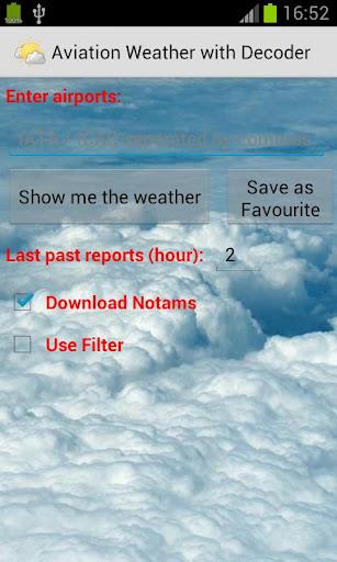
This indispensable weather app delivers precise, real-time meteorological data for seamless flight planning. Access multiple weather reports concurrently, simplifying your pre-flight preparations. Analyze historical weather patterns to enhance your understanding of weather trends. The app neatly stores reports and NOTAMs, ensuring all critical information is readily available.
Easily locate airports using ICAO/IATA codes or airport names, and instantly visualize them on Google Maps. Personalize your experience by adjusting text color, size, and font for optimal readability. Helpful tools like a METAR decoder, VOLMET access, and a crosswind calculator are also included. Stay ahead of the weather and optimize your flight operations.
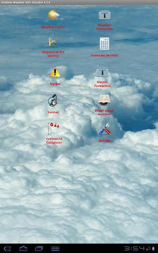
Key Features:
- Multi-Report Access: Simultaneously monitor weather conditions at multiple locations.
- Historical Weather Data: Review past weather reports to identify patterns and trends.
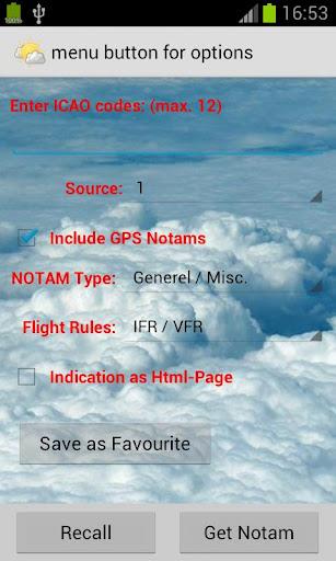
- Report & NOTAM Storage: Conveniently save and retrieve vital weather information and notices.
- Intuitive Input: Quickly find weather reports using ICAO/IATA codes or airport names.
- Google Maps Integration: Visually pinpoint airports on Google Maps for efficient route planning.
- Customizable Interface: Tailor the app's appearance to your preferences by adjusting text settings.
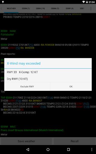
- Essential Tools: Utilize built-in METAR decoder, VOLMET access, and crosswind calculator.
Summary:
Aviation Weather with Decoder offers a comprehensive suite of tools for accessing and interpreting METAR and TAF reports from NOAA. Its ability to display multiple reports, access historical data, store information, and provide a customizable interface ensures an efficient and user-friendly experience. Google Maps integration and the inclusion of specialized aviation tools further enhance its value for pilots and aviation professionals. Download today and experience informed decision-making in the skies.
Tags : Tools