OfflineMaps: Your Offline Navigation Solution
OfflineMaps provides extensive map access, boasting a key advantage: no ads, data sharing, monetization, or third-party libraries.
Tired of waiting for maps to load? OfflineMaps ensures quick access, even without internet connection. Maps are cached for instant retrieval offline.
Key Benefits:
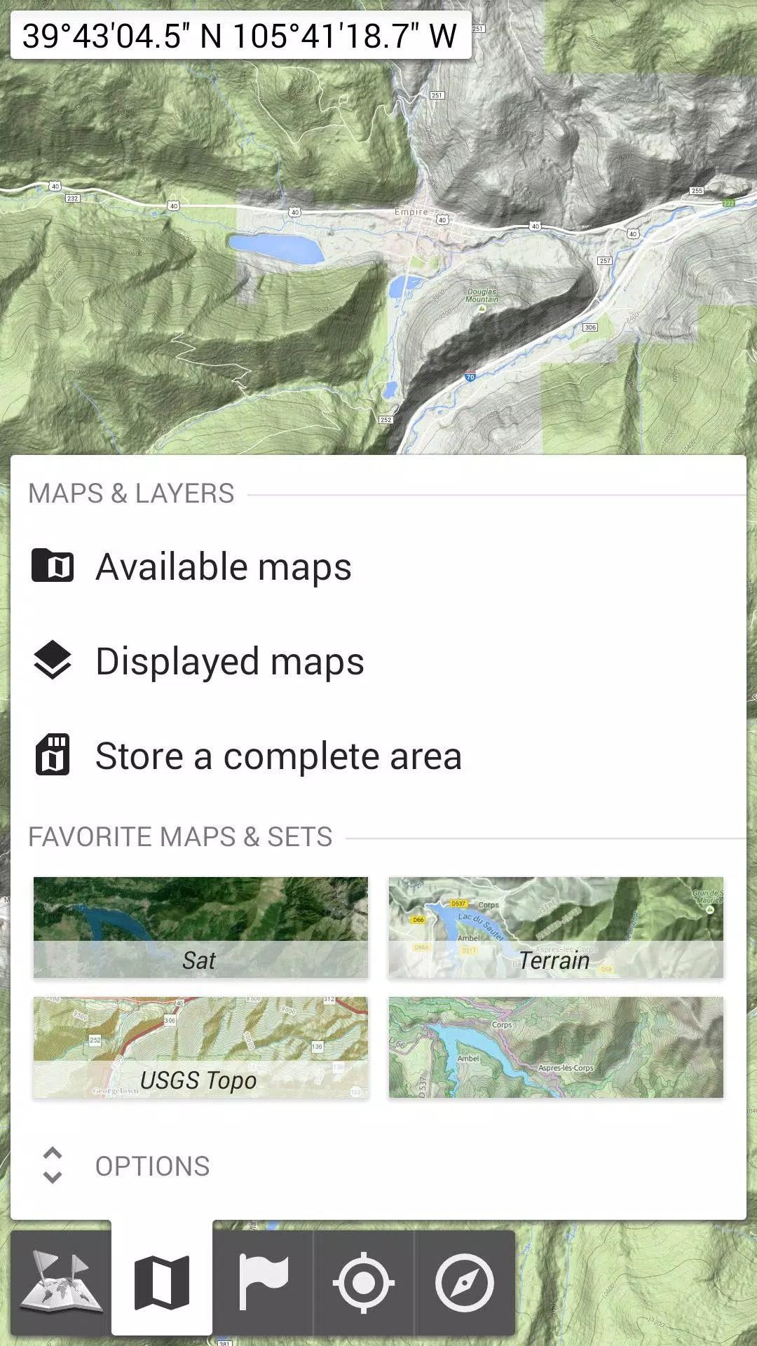
- Beyond Basic Road Maps: Access topographic maps, aerial imagery, and various specialized overlays.
- Reliable Offline Access: Perfect for areas with weak or no network coverage.
- Ideal for International Travel: Never get lost abroad again.
- Data Savings: Significantly reduces data usage while traveling.
Features:
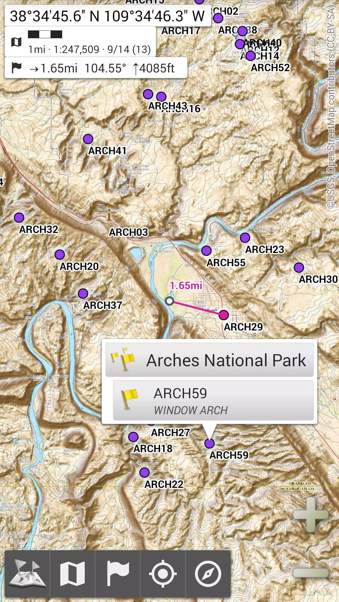
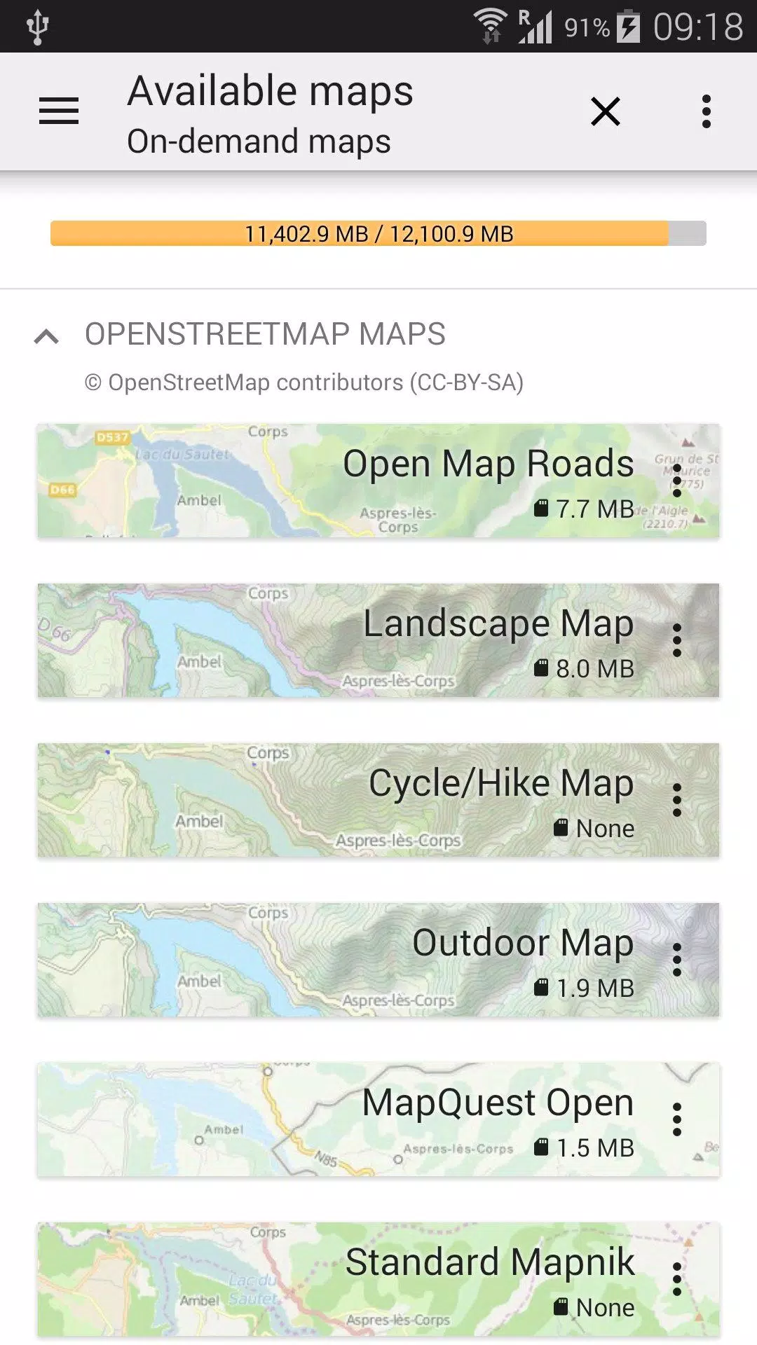
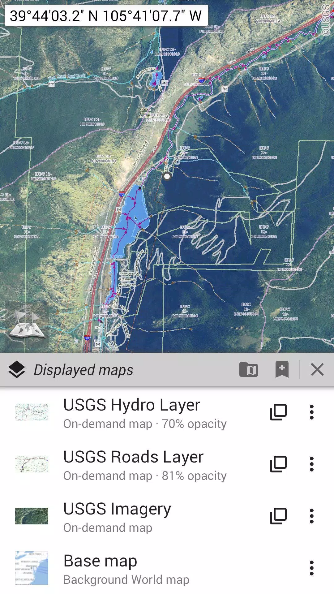
Extensive Map Selection: Choose from road maps, topographic maps, satellite imagery, and numerous overlay layers, including OpenStreetMap, USGS National Map, and even historical Soviet military topographic maps.
- Customizable Layering: Stack maps with precise opacity controls.
- Efficient Area Selection: Easily select and save large map areas.
- Simple Storage Management: Clear and easy-to-use storage management for deleting saved maps.
Unlimited Placemarks: Add and manage waypoints, icons, routes, areas, and tracks directly on the map. The built-in SD-Card Placemarks Explorer simplifies management.
Integrated GPS: View your real-time location and orientation on the map. Rotate the map to match your compass heading (device dependent). Easily toggle GPS on/off to conserve battery.
Additional Features:
- Flexible distance units (metric, imperial, hybrid)
- Multiple coordinate formats (UTM, MGRS, USNG, and many more)
- Import coordinates from https://www.spatialreference.org
- On-map grid display
- Full-screen map view
- Multi-touch zoom
For Advanced Users:
Explore AlpineQuest Off-Road Explorer, a comprehensive outdoor navigation app built upon OfflineMaps, featuring a powerful GPS track recorder and more: https://www.alpinequest.net/google-play
Tags : Maps & Navigation